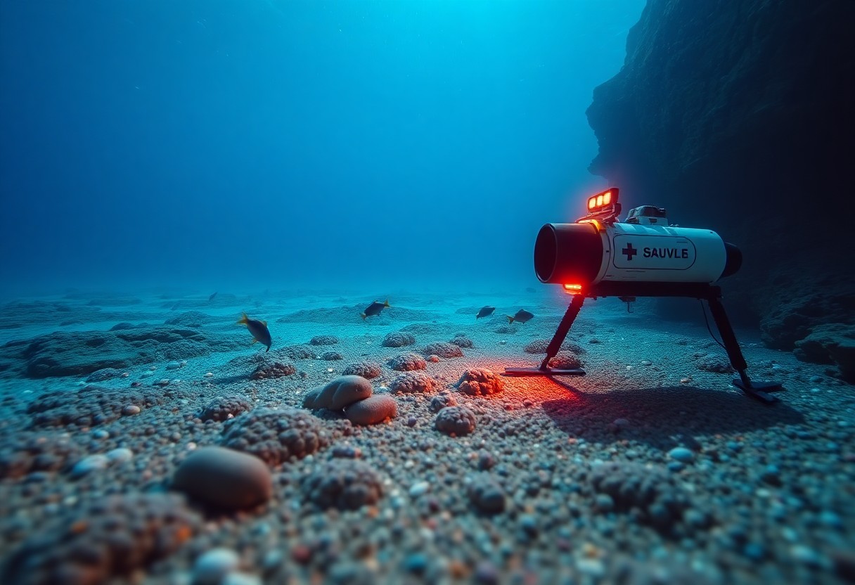
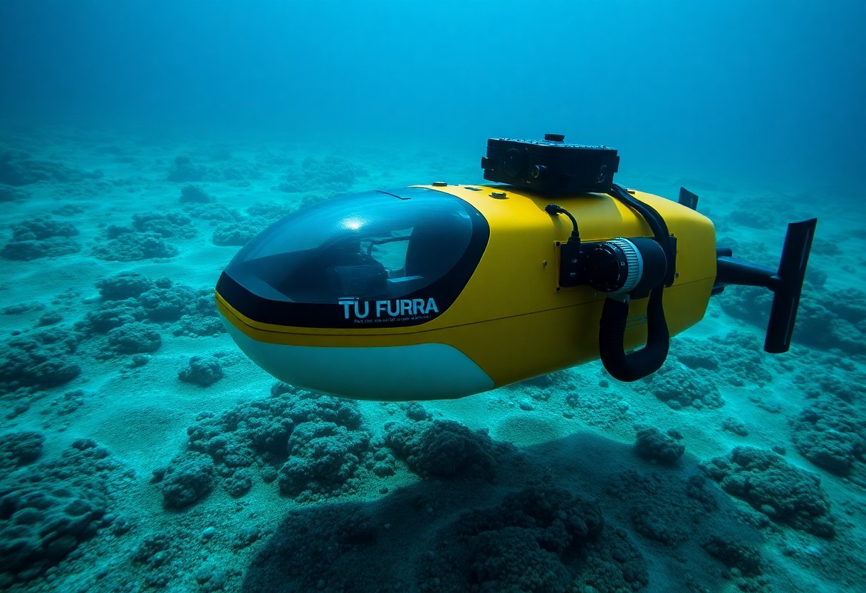
With the advancement of technology, you may find yourself wondering how autonomous underwater vehicles (AUVs) are transforming seafloor mapping. These remarkable machines are equipped with cutting-edge sensors and navigation systems, allowing them to explore underwater environments more efficiently than traditional methods. By utilizing AUVs, you can obtain high-resolution maps of the seafloor, enabling better understanding of marine ecosystems, resource management, and geological studies. In this blog post, we will explore into the specific roles and benefits of AUVs in seafloor mapping, enhancing your grasp of this fascinating technology.
Navigating the Depths: The Technological Backbone of Autonomous Underwater Vehicles
Your understanding of autonomous underwater vehicles (AUVs) is incomplete without acknowledging the technology that enables their remarkable capabilities. These vehicles leverage advanced navigational systems, including global positioning systems (GPS) and inertial navigation systems (INS), to maneuver through challenging underwater environments. By combining sonar and imaging technologies, AUVs can map the seafloor with exceptional precision, making them invaluable for deep-sea exploration and habitat monitoring.
Key Technologies Enabling AUV Functionality
Several key technologies empower AUVs, including advanced propulsion systems, communication networks, and autonomous decision-making algorithms. With the integration of artificial intelligence, these vehicles can adapt to their surroundings, optimize navigation routes, and efficiently process data while submerged. Your understanding of these technologies enhances your appreciation for AUV capabilities in various applications, from scientific research to maritime security.
Sensor Integration for Enhanced Accuracy
Sensor integration significantly boosts the accuracy of data collected by AUVs. By combining multiple sensor types, such as multi-beam sonar, side-scan sonar, and synthetic aperture sonar, you gain comprehensive insights into underwater terrains. This fusion of data allows for the generation of high-resolution maps, revealing intricate features of the seafloor that would otherwise remain hidden.
Achieving accurate seafloor mapping involves the strategic use of different sensors to complement one another. Multi-beam sonar provides detailed depth information across a wide swath, while side-scan sonar captures high-resolution images of the seafloor. By merging data from these technologies, AUVs create a rich dataset that offers both topographic details and features such as shipwrecks or natural formations. You can visualize the power of this integrated approach, as it allows researchers to study marine ecosystems with unprecedented clarity, facilitating better ecological assessments and conservation efforts.
Mapping the Unseen: How AUVs Transform Seafloor Surveying
Autonomous Underwater Vehicles (AUVs) have revolutionized the landscape of seafloor surveying, providing unprecedented insights into underwater ecosystems and geological formations. Equipped with advanced sonar systems and sensors, these vehicles can traverse vast and often treacherous underwater terrains, mapping areas previously inaccessible or too dangerous for human divers. By automating the data collection process, AUVs enhance both the efficiency and accuracy of seafloor mapping, paving the way for more informed decision-making regarding marine conservation and resource management.
The Process of Collecting High-Resolution Data
Utilizing a range of state-of-the-art technologies, AUVs collect high-resolution data by employing multi-beam sonar systems, which generate detailed bathymetric maps of the seafloor. These systems can capture thousands of soundings per second, allowing for the creation of precise topographical models. Furthermore, onboard sensors can analyze water quality parameters and track underwater habitats, enabling you to gain a comprehensive understanding of marine environments.
Advantages of AUVs Over Traditional Surveying Methods
The benefits of utilizing AUVs for seafloor surveying are numerous, fundamentally altering how you approach marine exploration. Traditional surveying methods often involve costly and time-consuming manned ships, limiting both the scope and speed of your projects. In contrast, AUVs can operate at a fraction of the cost and can cover larger areas more quickly, all while providing more accurate and detailed data due to their advanced technological capabilities. Cold water environments or depths beyond the reach of human divers pose no barrier for AUVs, which can be deployed on longer missions without the risks associated with human presence. This not only enhances data reliability but also allows for continuous collection over extended periods, providing you with the best possible insights into the underwater world.
From Data to Insights: The Role of Machine Learning in Seafloor Mapping
As AUVs gather vast amounts of data during seafloor surveys, machine learning emerges as a powerful tool for transforming that raw data into valuable insights. By automating the analysis of complex datasets, machine learning algorithms identify patterns and anomalies that are not immediately apparent to human analysts. This enhances the efficiency and precision of seafloor mapping, allowing for the generation of detailed maps that provide a deeper understanding of underwater topography and habitats.
How Algorithms Improve Mapping Accuracy
Algorithms trained on diverse datasets enhance mapping accuracy by filtering noise and correcting inconsistencies. For instance, convolutional neural networks analyze sonar data to detect features like underwater canyons or reefs, improving detection rates by over 30%. This level of accuracy not only boosts confidence in data interpretations but also reduces the time and resources needed for follow-up field studies.
Applications of Machine Learning Models in Data Interpretation
Machine learning models serve various applications in interpreting seafloor mapping data. For instance, supervised learning can classify different seafloor types, while unsupervised learning algorithms can cluster feature sets to reveal previously unknown geological formations. These applications help marine biologists and oceanographers understand ecosystems, track biodiversity changes, and monitor human impacts on marine environments.
Further exploration of machine learning applications reveals transformative impacts on marine research. For example, models analyzing acoustic data differentiate between living organisms and non-biological artifacts, thus allowing researchers to monitor fish populations without disturbing the environment. Additionally, machine learning excels in predicting sediment transport patterns and assessing potential hazards like underwater landslides. This ability to analyze multifaceted datasets enables a comprehensive view of seabed dynamics, fostering informed decision-making in conservation and resource management initiatives.

Real-World Applications: Charting the Oceans for Various Sectors
Autonomous underwater vehicles (AUVs) have revolutionized seafloor mapping across diverse industries. In sectors such as oil and gas, fisheries, environmental monitoring, and maritime navigation, AUVs provide sophisticated data collection capabilities that help in making informed decisions. Their ability to cover vast oceanic regions efficiently and with high accuracy enables you to unlock insights into underwater ecosystems, resource potential, and site suitability for various projects.
Environmental Monitoring and Conservation Efforts
With AUVs, you can monitor marine ecosystems closely, assessing health indicators and tracking biodiversity. These underwater vehicles gather data on water quality, sediment composition, and the distribution of fragile species, which aids in conservation efforts. By mapping sensitive habitats, AUVs inform management decisions that protect vital marine environments from degradation.
Enhancing Maritime Navigation and Infrastructure Development
AUVs play a central role in enhancing maritime navigation and ensuring safe infrastructure development. Their ability to create precise seabed maps allows for better route planning and hazard identification, significantly reducing navigational risks. You can also leverage this data for optimizing port construction and expansion, as well as laying underwater cables and pipelines with improved accuracy.
Utilizing AUV technology in maritime navigation has led to safer shipping routes and reduced operational costs. By providing real-time data about underwater obstacles, currents, and seabed conditions, you can navigate hazardous areas confidently. Moreover, AUVs enable port authorities to streamline infrastructure projects by ensuring that construction adheres to environmental standards and minimizes disruptions to marine life, creating a more sustainable approach to maritime development.
The Future of AUVs in Marine Exploration: Trends to Watch
The evolution of autonomous underwater vehicles (AUVs) is set to significantly impact marine exploration in the coming years. Emerging technologies, such as enhanced autonomy and AI-driven data processing, will allow AUVs to operate in more challenging environments and cover larger areas more efficiently. As industries like oil and gas, environmental research, and climate monitoring demand precise data, you can expect AUVs to become even more integral to these endeavors.
Innovations on the Horizon
Advancements in battery technology and energy efficiency will enable AUVs to conduct longer missions without needing frequent recharges. Furthermore, the incorporation of advanced sensors will enhance data collection capabilities and improve the accuracy of seafloor mapping, making future explorations more insightful than ever before.
Potential Regulatory and Ethical Considerations
The rise of AUVs in marine exploration inevitably brings forth regulatory and ethical challenges that must be addressed. As you navigate these advancements, consider the implications on marine ecosystems, data privacy, and adherence to international maritime laws.
As AUV technology becomes increasingly pervasive, the push for regulatory frameworks to manage their use in the ocean is becoming more pressing. You may encounter discussions around establishing guidelines for environmental protection, especially concerning the preservation of vulnerable marine habitats. Ethical issues related to data ownership and privacy in shared oceans also necessitate clear governance. Moreover, as AUVs continue to expand their operational boundaries, navigating the legal implications of autonomous missions, such as interactions with manned vessels or adherence to international laws, will be vital to ensuring responsible use of these cutting-edge tools in our oceans.
To wrap up
Conclusively, you should recognize the significant role that autonomous underwater vehicles (AUVs) play in seafloor mapping. These advanced technologies allow you to obtain high-resolution data, efficiently survey vast ocean areas, and reach depths that are otherwise challenging to access. By utilizing AUVs, you can enhance your understanding of underwater terrains, aiding in marine research, resource exploration, and environmental management. As you embrace these innovations, your ability to navigate and comprehend the complexities of our oceans will undoubtedly improve.
